Snow totals of 8-10″ in the area were much more than forecast just 12 hours before hand.

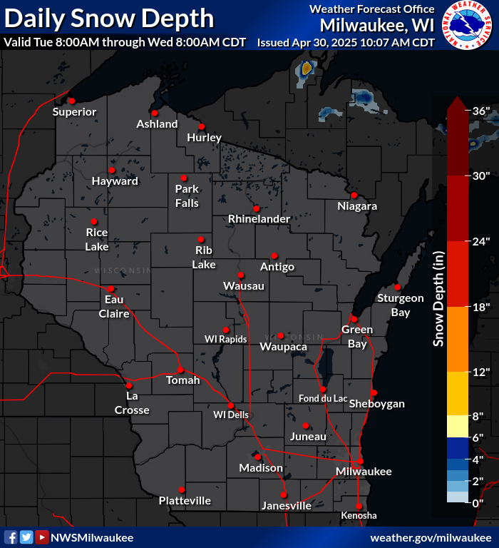
Snow Totals 1-14-14
That leaves the area with over a foot and some closer to two feet of snow depth. Look at that 27″ report at Shawano!!!

Snow Depth 1-14-14
We should add some more snow over the next few days. There are the normal differences in models but all give us at least a little bit more. The NAM model posted below suggests another 4-6″ from a couple clipper systems through Saturday. No major warm-up expected. Thursday and Sunday highs will be near 30 but otherwise highs will be in the teens. Next week looks like it could be VERY cold, similar to the cold snap a couple weeks ago.

SAVE THE DATE FOR OUR FUNDRAISERS!

Winter Family Fun Weekend – Feb 1 & 2